Our Summer Cruise 2016
May 16 - 22 |
May 23 - 29 |
May 30 - Jun 5 |
Jun 6 - 12 |
Jun 13 - 19 |
Jun 20 - 26 |
Jun 27 - Jul 3 |
Jul 4 - 10 |
Jul 11 -17 |
Jul 18 - 24 |
Jul 25 - 31 |
Aug 1 - 7 |
Aug 8 - 14 |
Aug 15 -21 |
Aug 22 - 28 |
Aug 29 - Sep 4 |
Sep 5 - 11 |
Sep 12 - 18 |
Sep 19 - 25 |
Monday, June 6
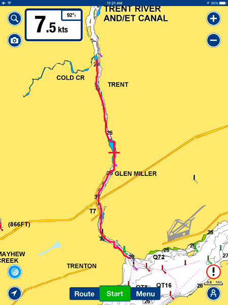
The Last Leg on The Locks - Frankford to Trenton - 7nm
No rush today as the lock does not open until 10:00 am so gave the boat a quick wash and a wipe down after a short rain shower. The sky looked threatening several times during our passage through the six remaining locks to Trenton and then sun and blue patches would appear.
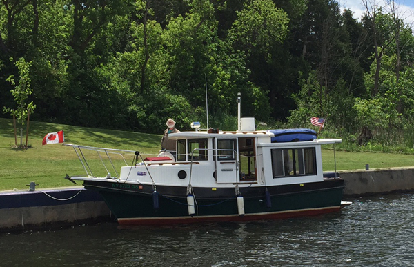
Interesting Little Tug Waiting to Lock Up
The lock staff were very efficient today and we had few delays on the remaining locks before we were out in open water and going under the last bridge on the System
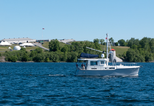
The View From the Stern of STB
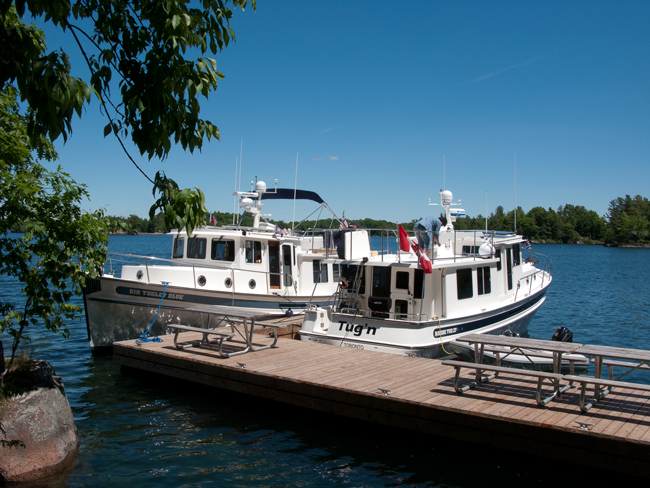
We were soon in contact with the new Trenton Port Marina, open this year for its first full season. Other than trying to stuff a 13' wide boat into a 13' space which we declined, we were soon tied up alongside "Wings" with "Tug'n" opposite and being welcomed by Craig, the facility manager,who we knew from the old Fraser Park Marina. In less than 30 minutes, we had Bob's mast erected and it looked much better than having the missile launcher look.
Fran and Stephen took off for an anchorage a few hours further on while we did shopping, laundry, an LCBO run, showers, etc. Time flew by and it was 7:00 pm before we knew it. Food and an early night.
The marina is truly impressive with over 370 slips spilt evenly between transient and seasonal slips. It must rank as one of top marinas in North America.
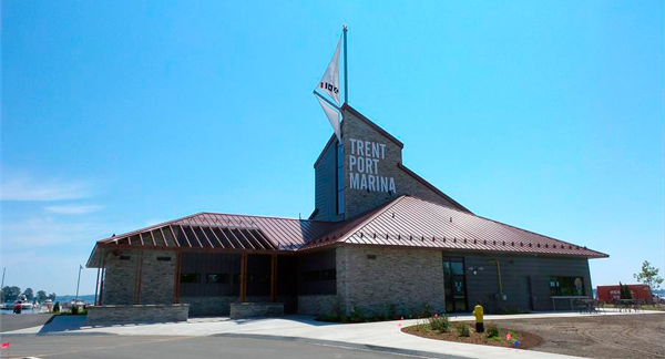
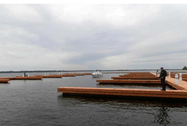
The New Marina
The new marina is very good value at $67 Canadian for our boat and this includes water, electricity, washers and dryers, and even detergent.
It's now been three weeks since we left the dock at Whitehall. In that time, we have put 105 hours on the engine and covered around 750 miles. In the past eleven days, we have been through 44 locks and rose to a height of 260 feet above Georgian Bay and then dropped 590 feet to Lake Ontario. We had one weather day in Frankford. For the next week or so, we are done with locks until we enter the big locks on the St. Lawrence Seaway.
Tuesday, June 7
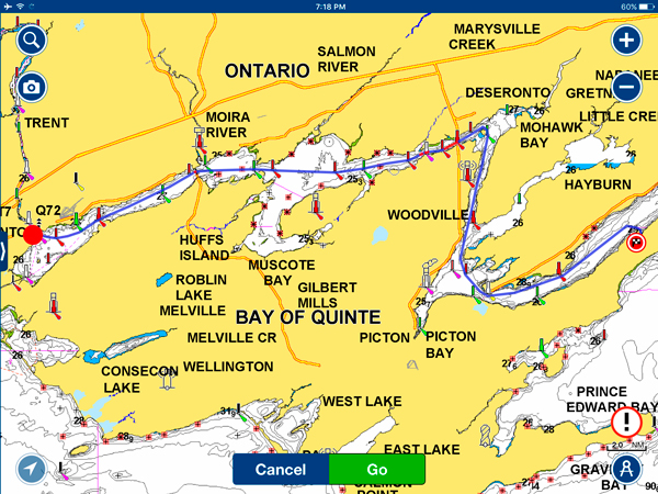
Trenton to Prinyr Cove - 43 nm
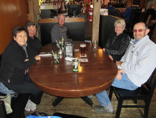
Another cooler morning. We joined Bob and Jan for breakfast at the diner next to the Blue Room Restaurant on the main street. The diner is a Trenton fixture and opened in the early 50s. The owner, who is now 92, still arrives every day at around 5:30 am to get things set up for the morning opening at 6:00 am and he does this seven days a week. The diner still has the original soda bar and jukeboxes at each table. Excellent food and inexpensive to boot!
Today's plan was to meet up with Stephen and Fran where they had anchored last night and then run on to Prinyr Cove in the Adolphus Reach just past Picton. The forecast stronger winds did not come to much so we had a good run to meet up with "Tug'n" just past the Telegraph Narrows Bridge, impressive at just over 100 feet high but paling in comparison to the Big Mac.
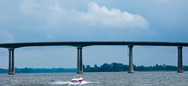
Telegraph Narrows Bridge
Together again, we made our way south and then east along the Reach with just a few rainshowers to Prinyr Cove, a large bay with excellent protection from the forecast strong West to Northwest winds later in the day. There were many boats on moorings in the bay but we had plenty of room to anchor in about 25' of water with ample swinging room. The new Rocna anchor is very impressive in its ability to dig in very quickly and hold without much backing up of the boat.
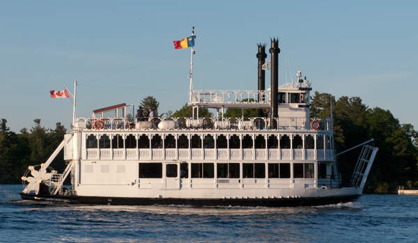
It was a quiet day on the water again with only a couple of boat around, one of them being the ferry that runs at regular intervals from the mainland to Prince Edward Island.
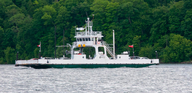
The "Glenora"
Wednesday, June 8th
Prinyr Cove to Kingston - 22 nm
An early departure today for Kingston with no real sign of the heavy winds forecast earlier, just a few rainshowers and cooler temperatures with a bit of rolling in the two areas open to Lake Ontario. We made a short detour into Collins Bay just west of Kingston for a pumpout and to pick up some parts for "Tug'n". This was our first pumpout since Frankfort and we were only around half full. Quite impressive compared anchoring out when we only get about 14 days. We do however make a conscious effort to use lock and marina facilities where possible.
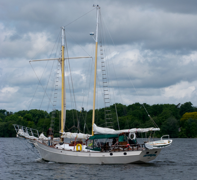
One of the Few Boats Passed - "Interlude"
It was a bit gloomy and windy when we first arrived in Kingston and, after some confusion on slip asignments and an injured otter on our docks, they finally got us all tied up together in the right place. We were exactly where we were in 2013 except the marina was only about 25% full compared to overflowing. No day dock hassle this time - there are some advantages in being early in the season. The weather even cleared up.
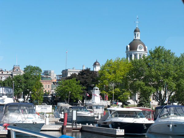
Kingston's Confederation Basin Marina
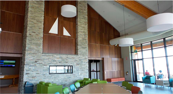
The crews were hungry (as usual) and we enjoyed the lunch time specials at the Aspora Angkor Thai restaurant just round the corner from the marina. Highly recommended! As a bonus, we found tomorrow night's entertainment - the Kingston Ceili Band performing at the Royal Canadian Horse Artillary Club next door.
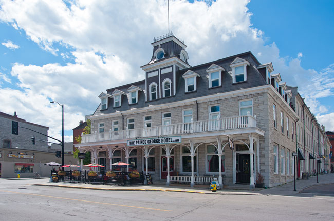
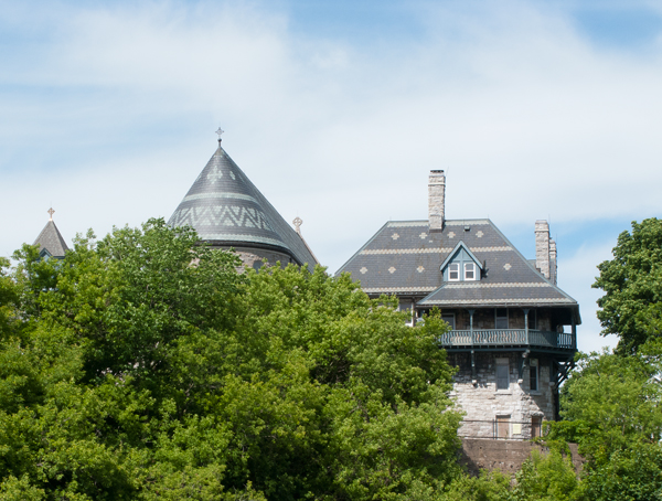
One of the Early Limestone Buildings - the Prince Hotel (survivor of three fires)
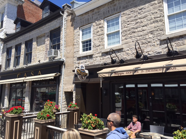
Judy and I took off for a wander around the city's main street, Princess St, which was completely torn up for major sewer, water, gas, and electricity replacement. All of the stores were accessible though sidewalks were rudimentary. Scheduled completion is June 30 but I would not bet on that. We struggled to find the Bosun's Locker, a small marine store, with no luck until we were on our way back and I spotted a small sign on the frontage of the General Store. It was on the second level of the store and had two of the three things I needed, some electrical cable and Tide Tables.
Thursday, June 9th
The Three Amigos were up early for breakfast at one of Judy's favorite bakeries, Pan Chancho at the bottom of Princess Street. Apart from being a fine bakery and deli, they have an excellent cafe upstairs with good coffee (try their lattes) and a range of breakfast goodies.
Time to tour Kingston again. We joined Bob and Jan on the "on and off" Trolley Bus tour we had done on our last visit while Fran and Stephen were meeting up with some old friends for the day. It was a bit cool but our open Trolley did have side curtains to cut the breeze somewhat as we left the old Kingston Train Station and the locomotive below behind. We had some bad luck at the start - the audio narration went out; but also had some good luck as they changed the driver out and Patrick, our new driver, gave us an excellent ad-hoc narration as we circled the city.
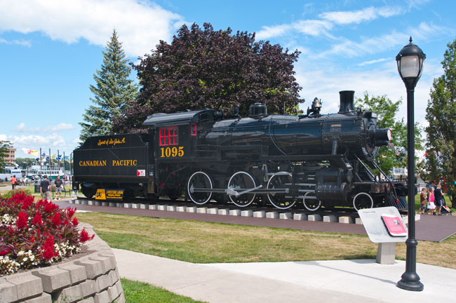
Spirit of St. John A. - an early 1900s Locomotive at the Old Train Station on the Waterfront
Kingston was a major economic, military, and political center in the 17 and 1800s and the tour highlighted many of these aspects with the first stop at the Royal Military College of Canada which opened in 1876 with 18 gentlemen students. The College functions much like West Point in the US with graduates earning degrees in the arts, sciences, and engineering, going on to become junior officers in the Canadian Armed Forces.
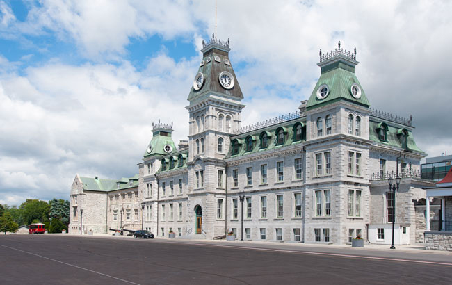
Military College - (the West Point or Sandhurst of Canada)
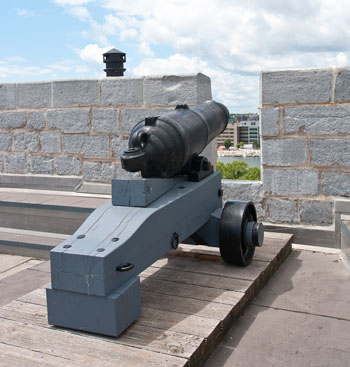
Next on the ride was a look at the outside of Fort Henry. The original fort was constructed during the War of 1812 to protect the Kingston Royal Naval Dockyard (the site of the present-day Royal Military College of Canada) on Point Frederick from a possible American attack and monitor maritime traffic on the St. Lawrence River and Lake Ontario. The original fort was replaced by a much larger construction in the 1830s to maintain protection of the naval dockyard and protect the southern entrance to the Rideau Canal. The fort was restored in the 1930s and is a significant tourist attraction today. While not looking too impressive from the outside as much of it is below the surrounding ground level, the walls are protected by a deep "moat" designed to defend against ground forces. Its real strength lies in its firepower on the ramparts that can reach all of the approaches to Kingston and the Cataraqui River.
Our tour continued back to the city to see some sights including the Farmers' Market, the Town Hall, and parts of the residential areas to the west that included some of the fine old buildings.
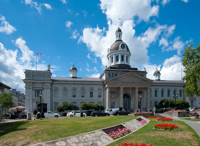
Town Hall
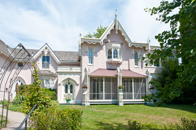
Eliza House
Princess St. Cafe
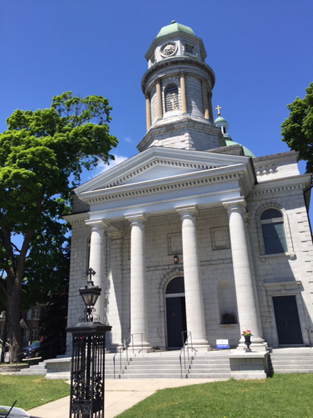
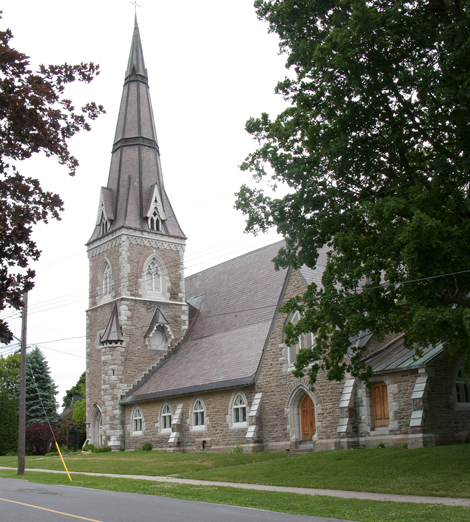
St. Georges Cathedral
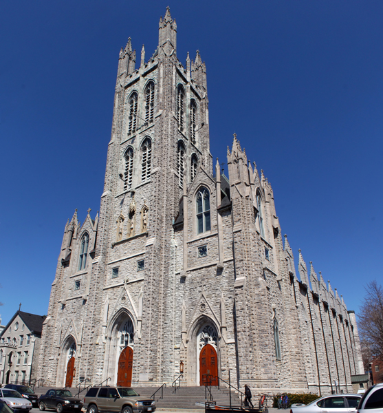
St. Mary's Cathedral
Our next stop were the Kingston Womens and Mens Penitentiaries, both recently retired from active use. The Men's Penitentiary was opened in 1835 and became a maximun security prison later in its life until its closure in 2012. It had a grim reputation and was the scene of several bloody riots.
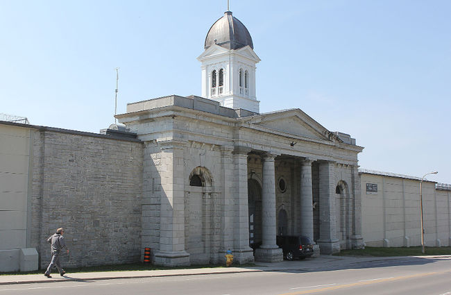
The Kingston Pen
Unlike our previous tour, we spent more time in the western area around Queens University than before, probably due to construction downtown, so we got to see some areas we missed. Patrick, our driver, was a recent graduate of Queens so he had plenty to tell us about the university history, (founded in 1841) and its buildings including the new Isabel Bader Center for the Performing Arts, made possible by a $50 million donation from one of Queens alumni.
On our way round we picked two places we wanted to go back to so took the bus partway round the the Maritime Museum of the Great Lakes on the waterfront at the Kingston Drydock, itself a historic location built in 1890 where large vessels could be worked on. The Canadian Coast Guard Icebreaker, Alexander Henry, retired in 1986 is one of the key exhibits of the museum and visitors are free to roam over much of the vessel.
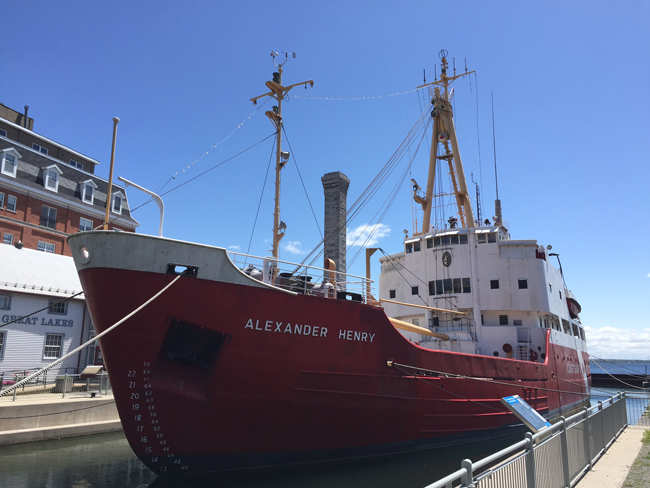
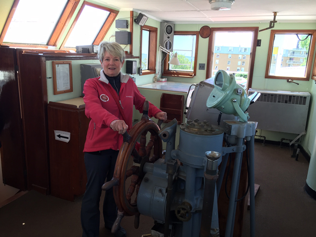
Ready to Break Some Ice!!
Unfortunately, the Museum site has been sold to a developer by the federal government and the Museum is in the process of seeking a new site, probably not in Kingston. What will happen to the Drydock and its associated pumphouse is unclear but condos are in the plans. What a shame to lose such a heritage site!
Our final stop for the day was at Bellevue House, the residence of John A. McDonald, Canada's first Prime Minister from 1848 to 1849. While he lived there for just a year, it is now a national Historic Site and has been restored to its original condition with period furniture and is an excellent example of how he and his wife would have lived at that time. Today it is staffed by period costumed guides and workers who have an excellent knowledge of the home and John A's life.
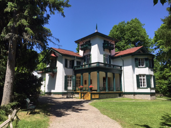
Bellevue House
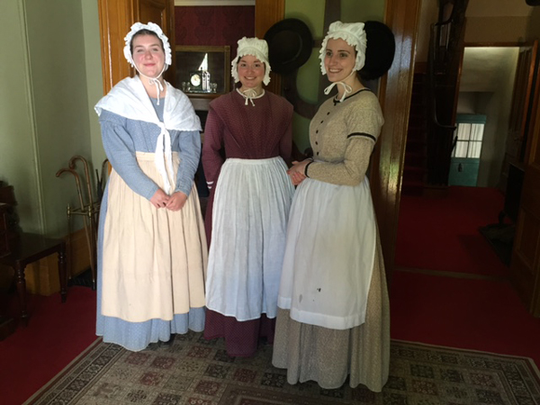
Some of the The Staff
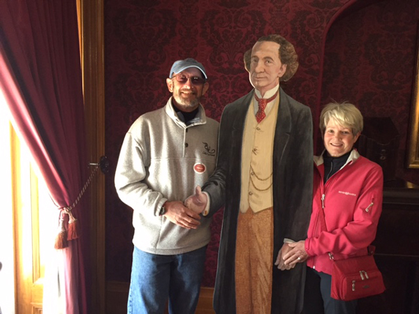
Meeting John A. McDonald
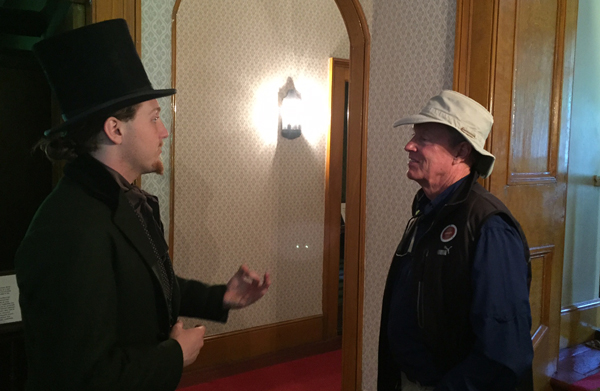
Bob and One of John A's Friends
A thoroughly enjoyable day in Kingston again! One of our favorite stops on the trip so far.
After a good dinner at Woodenhead's near the Marina, we joined up with the rest of the gang at the Royal Canadian Horse Artillery Club for an free evening of Celtic music with the Kingston Ceili Band, the foremost band of its type in the region. The band has been around since the '80s in various forms and tonight was comprised of an accordianist, a fiddler, a drummer (bodhranist??), a flautist who played a variety of flutes and whistles, and a guitarist who was also the lead vocalist. It was easy to see why they are "the foremost" as they played and sang a great selection of traditional and more contemporary tunes with the good crowd joining in on some of the more well-known songs. The Caffreys was good as well.
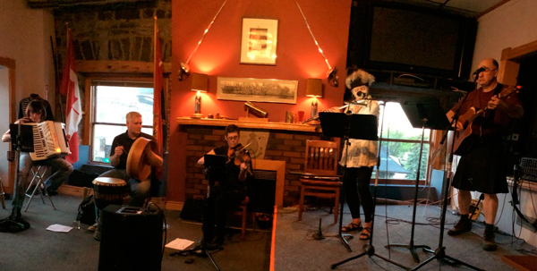
The Kingston Ceili Band
Friday, June 10
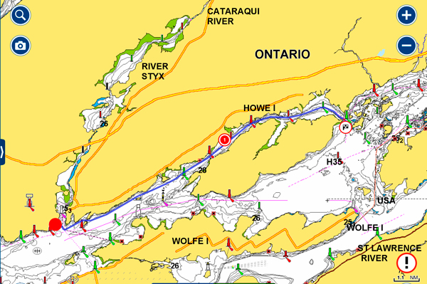
Kingston to Aubrey Island - 14 nm
A cool morning but very sunny as we depart from Kingston to begin our long journey down the St. Lawrence River to the Atlantic Ocean.
"Wings" with Fort Henry in the Background
The St. Lawrence River begins at the outflow of Lake Ontario just past Kingston and flows through Gananoque, Brockville, Morristown, Ogdensburg, Massena, Cornwall, Montreal, Trois-Rivières, and Quebec City before draining into the Gulf of Saint Lawrence, one of the largest estuaries in the world. The estuary begins at the eastern tip of Île d'Orléans, just downstream from Quebec City. The river becomes tidal around Quebec City with tides of 15 feet.
The St. Lawrence River runs 743 miles from the outflow of Lake Ontario. The farthest headwater is the North River in the Mesabi Range at Hibbing, Minnesota. Its drainage area, which includes the Great Lakes, the world's largest system of freshwater lakes, is over 700,000 square miles of Canadian and US land. The basin covers parts of Ontario and Quebec in Canada, parts of Illinois, Indiana, Minnesota, New York, Ohio, Pennsylvania, Vermont, and Wisconsin, and the entirety of the state of Michigan in the United States. The average discharge below the Saguenay River, about 130 miles past Quebec City, is 590,000 cu ft/s, thankfully going in our direction. Currents can reach up to 8 knots in certain areas depending upon tidal conditions, so it will be important to factor in the tides to the our departure times and how far we travel.
Oceangoing shipping today can transit the entire St. Lawrence, in part, due to the final construction phase of the St. Lawrence Seaway in the late 1950s that allowed large vessels to pass unimpeded, except by a system of locks, between Quebec City and Lake Erie. The part we will be traveling through was opened officially in June, 1959 by Queen Elizabeth and President Eisenhower. This completed the vision of Dollier de Casson, Superior of the Sulpician Seminary in Montreal, who began trying to build a 5 feet deep canal to bypass the Lachine Rapids between Lake St.Louis and Montreal in 1680; this canal was finally completed in 1824.
Enough history and geography! But maybe a little more.....
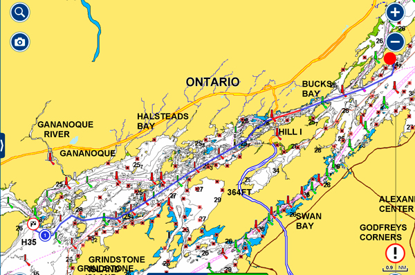
The first part of our journey takes us into the 1000 Islands, really a misnomer as they are an archipelago of 1,864 islands that straddles the Canada–USA border in the Saint Lawrence River as it emerges from the northeast corner of Lake Ontario. They stretch for about 50 miles downstream from Kingston, Ontario. The Canadian islands are in the province of Ontario, the US islands in the state of New York. Canada is home to the majority of islands with just over two-thirds in Ontario.
The 1,864 islands range in size from over 40 square miles to smaller islands occupied by a single residence, or uninhabited outcroppings of rocks that are only home to migratory waterfowl. To count as one of the Thousand Islands, emergent land within the river channel must have at least one square foot of land above water level year-round, and support at least two living trees.
In the late 19th and early 20th centuries, many distinguished visitors made the region widely known as a summer resort. Several grand hotels provided luxurious accommodations while steamboats offered extensive tours among the islands. Wealthy and middle-class summer residents built summer homes. Some masonry "castles" remain as international landmarks. The most famous extant examples are "The Towers" on Dark Island, now called Singer Castle, and the long-neglected Boldt Castle on Heart Island, much of which has been completed over the recent decades in accord with Mr. Boldt's original plans – hitherto, it had been left unfinished for over 75 years upon the untimely death of his wife. The original plans were updated to incorporate numerous current technological conveniences.
During the half century (1874–1912) of the resort's greatest prominence, most wealthy vacationers came from New York City, joined by prominent families from Toronto, Montreal, Chicago, Cleveland, Pittsburgh and other cities of the United States and Canada. The region retains a historically important collection of vacation homes from this time. The Thousand Islands have long been a center for recreational boating. Large steam yachts, many designed by Nathanael Herreshoff required distinctive yacht houses. The region was known also for innovative power boating during this period.
The Antique Boat Museum of Clayton retains one of the world's major collections of recreational freshwater boats.
The region was also a part of the War of 1812 between the British Empire and the United States.
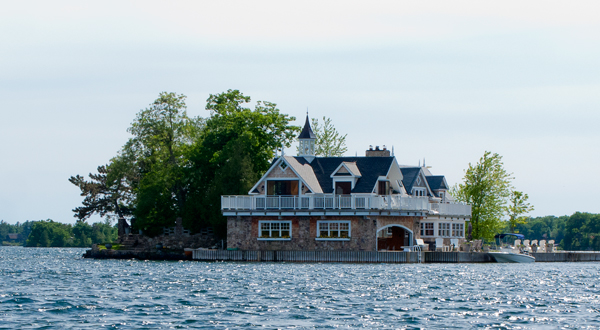
Unfortunately, we only have time for a fleeting glimpse of the 1000 Islands so we decide to go to one of the smaller islands, Aubrey, that is part of the Parks Canada system and the group of islands known as the Admiralty Islands. These were named after British Admirals in the War of 1812. After a relatively short run through the Bateau Channel with not too many buoys, we arrived at the island with three protected but short docks just waiting for us. We did not get to see the major "castles" but saw many mansions along the way.
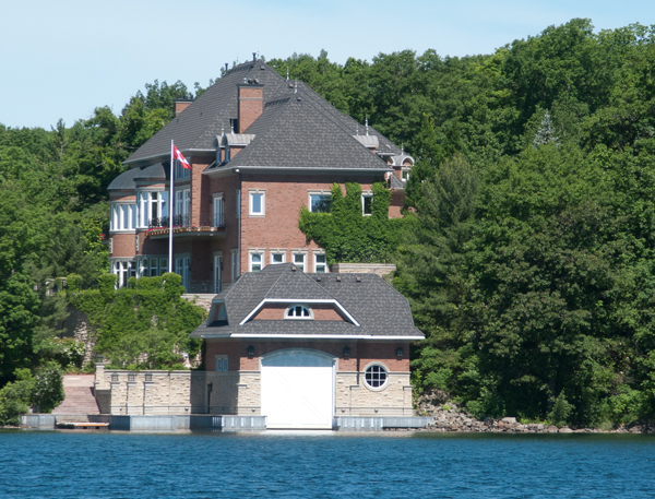
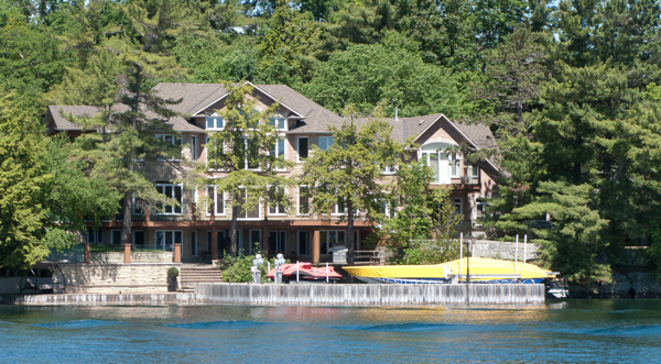
A Couple of the Bigger Homes Along the Way
At Aubrey Island
After a quick lunch, we head out in the dinghies for a run about 3 or 4 miles to the north to Gananoque, one of the "larger" towns in the 1000 Islands. We found a co-operative marine owner to let us tie up our dinghies and explore the town which obviously depends heavily on tourism but seems to have avoided the typical t-shirt shop after shop often found. Evidence of its historic past were evident in many ways.
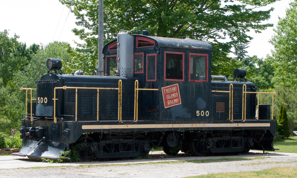
Gananoque Tourist Railroad Engine
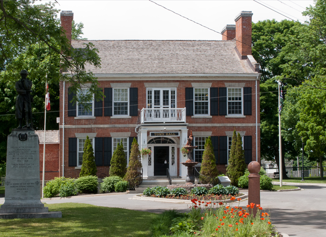
Town Hall
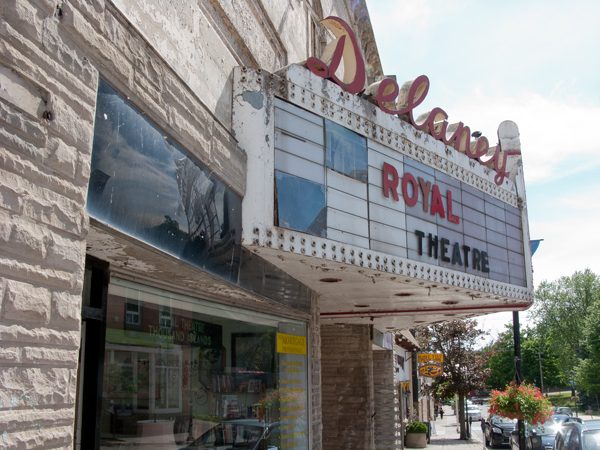
Theater Under Restoration
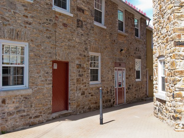
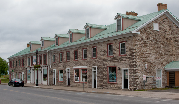
Well Preserved Stone Buildings
St. John The Evangelist RC Church
As well as the historic aspects of the town we also got to indulge, finally, in an ice cream for the first time this season and paired it up with sampling the beers at the local brewing company before heading back to the dinghies.
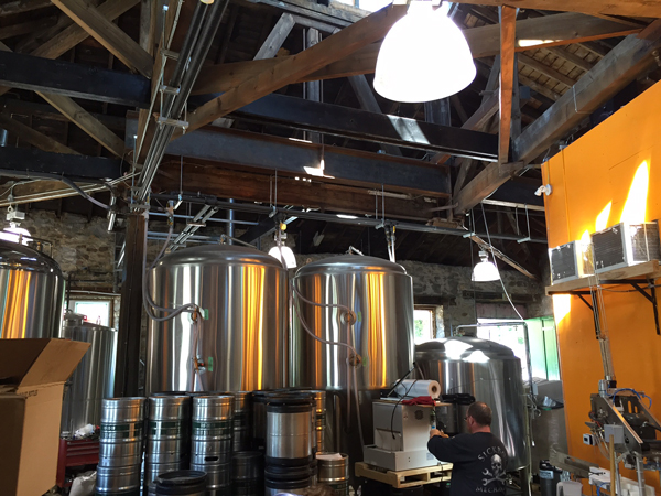
Gananoque Brewing Company
On our way back to Aubrey, we had a chance to see some of the one-home islands on the way. Just a modest one below:
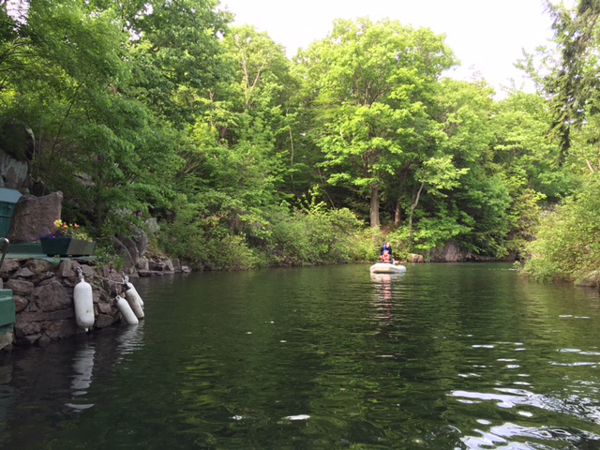
Stephen took a slight detour for us to visit Half Moon Bay situated on Bostwick Island. The Bay is a natural high-walled cove carved out of the island by retreating glaciers. In 1887, the tradition of worship in Half Moon Bay began with people coming from neighbouring islands and from Gananoque to meet for a Vesper Service early on Sunday evening during July and August. The Bay has excellent accoustics as a result of its shape and regular services have been held since. In Gananoque town, there is a large mural shown below.
Bob and Jan in Half Moon Bay
The Pulpit and Altar
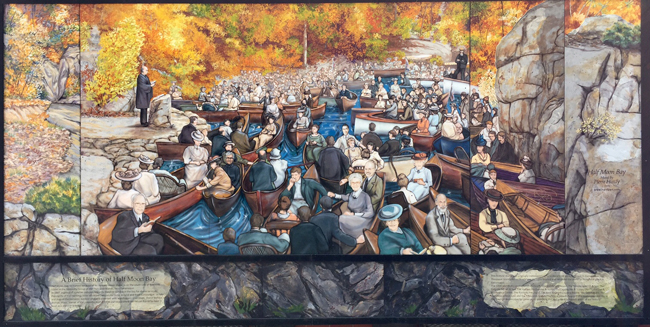
Back in the Day When they Came in Canoes
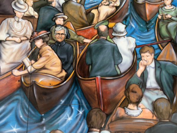
Detail of Mural
David Wallace, from Amesbury Massachusetts designated this piece of his land in his will "always for a place for the Worship of God and for no other purpose".
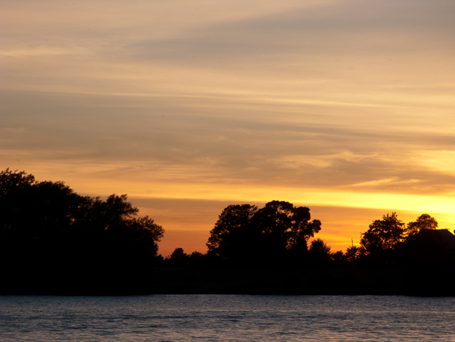
For the rest of the day, we enjoyed the peace and solitude of Aubrey Island with the occasional disruption from the wakes of the tour boats' that pass through some very tight areas of the 1000 Islands. The day ended with quite a good sunset as well.
Saturday, June 11
Aubrey Island to Grenadier island - 16nm
Cold and wet this morning for our short trip to an anchorage or a Parks dock. Of the several we had selected, two were too small so we continued further on to our third choice, some docks on Grenadier Island named after the British Grenadier Guards Regiment. This island was "given by M. Frontenac to an Iroquois who sold it to a Canadian for four pots of brandy who in turn sold it back for one beaver pelt". This turned out to be not quite as isolated as Aubrey with about eight other boats on the docks but we were made welcome and managed to anchor and back into the slip. Again, we had a 20' dock for a 40' boat! There was quite a festive atmosphere on the docks with barbecueing, fishing, music and kids playing everywhere. The partying quietened down at a reasonable time and we had a good nights sleep.

Short Slipped Again!
Sunday, June 12
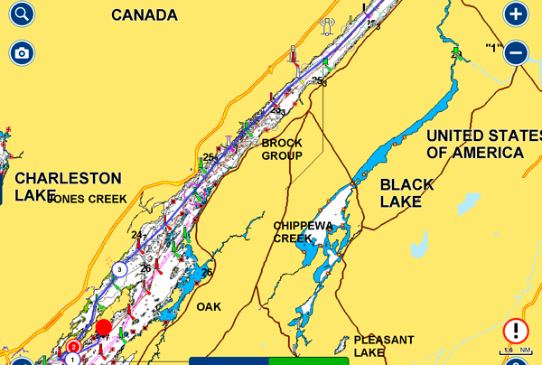
Grenadier Island to Prescott - 33 nm
We awoke to cool temperatures around 50 deg F. and gloomy skies so we all decided that it was a day to make progress and Prescott looked like a good destination with the first part of the journey well protected in the Small Craft Channel for at least 10 miles. Beyond that we would be in the main channel of the Seaway with the big ships. Our first encounter came just a short distance away at the Brockville Narrows where we decided that the oncoming vessel clearly had priority and we sought the protection of the Island mid-channel.
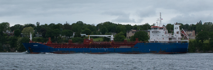
The Freighter, "Petras"
With intermittent rain along the way, we made Prescott, the home of a large Canadian Coastguard Station with two of their boats, the "Tracy" and the "Griffon".
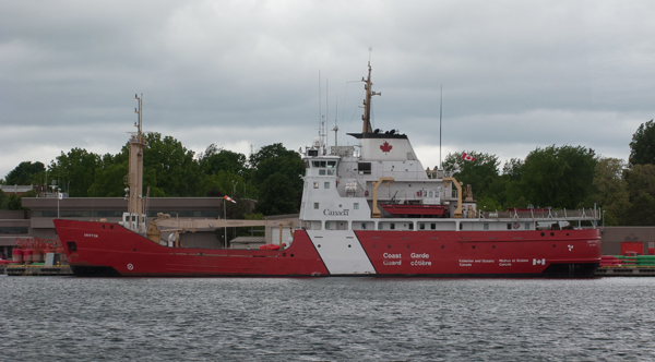
The Griffon is a 233' Light Icebreaker that usually works the eastern end of Lake Ontario and the St. Lawrence to Montreal but has seen duty as far north as Duluth, MN
We docked OK at the Prescott Town Marina but had short docks and narrow slips that could not take two of us side by side and heavy weed. By now we are used to that!. Lunch was calling and on the staff recommendation we headed for Heaphy's nearby. Good pub-style food and huge portions.
The Three Amigos at Heaphy's
While the rest of the group did washing, etc. Judy and I took a brisk walk of 20 minutes each way to the supermarket and Canadian Tire to stock up the boat. After, I took a walk around Prescott to see what it had to offer and was surprised with what I found in some of the residential areas.
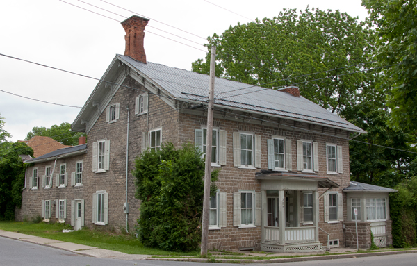
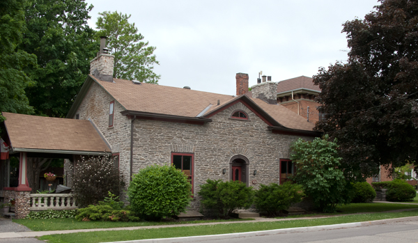
Reading more about the town, it was clear that Prescott was an important and prosperous town in its day as a shipping center. Goods from the west, were offloaded here for transport by other vessels to the east and vice versa.
May 16 - 22 |
May 23 - 29 |
May 30 - Jun 5 |
Jun 6 - 12 |
Jun 13 - 19 |
Jun 20 - 26 |
Jun 27 - Jul 3 |
Jul 4 - 10 |
Jul 11 -17 |
Jul 18 - 24 |
Jul 25 - 31 |
Aug 1 - 7 |
Aug 8 - 14 |
Aug 15 -21 |
Aug 22 - 28 |
Aug 29 - Sep 4 |
Sep 5 - 11 |
Sep 12 - 18 |
Sep 19 - 25 |