Our Summer Cruise 2016
May 16 - 22 |
May 23 - 29 |
May 30 - Jun 5 |
Jun 6 - 12 |
Jun 13 - 19 |
Jun 20 - 26 |
Jun 27 - Jul 3 |
Jul 4 - 10 |
Jul 11 -17 |
Jul 18 - 24 |
Jul 25 - 31 |
Aug 1 - 7 |
Aug 8 - 14 |
Aug 15 -21 |
Aug 22 - 28 |
Aug 29 - Sep 4 |
Sep 5 - 11 |
Sep 12 - 18 |
Sep 19 - 25 |
Monday, May 23
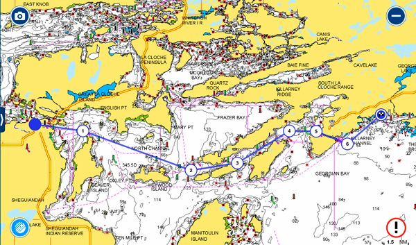
Today's Route - Hotham Harbor to Little Current - 19 nm
Up early for us again at 6:00 am and the anchor was pulled by 7:10 for our short run to Little Current. A little crispy at 42 deg. F but the sun soon warmed it up into the low 50s. Barely a ripple on the water except for Wing's wake in front of us.
A whole week has flashed by already with around 320 miles covered since we left White Lake last Tuesday - good progress. At this rate, we are projecting we will be at the south end of Georgian Bay on Thursday to meet up with Stephen and Fran on "Tug'n".
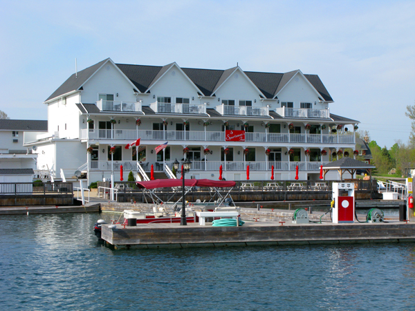
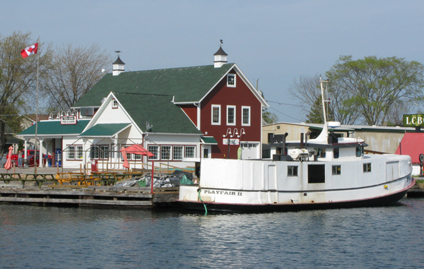
Little Current was very quiet for a holiday with everything closed up. The Town docks are still in their winter storage locations but, fortunately, the wall is always there and, better yet, was free with water and power.
Around noon Roy Eaton, the founder, host, and organizer of the Little Current Cruisers Net arrived to go out to lunch with us. If you haven't followed previous blogs, Roy hosts a morning radio broacast out of Little Current on the VHF radio from June to September giving news and weather, and cruisers call in with information, their current location, etc. He also organizes several pot luck dinners for the cruisers in Little Current and one in the winter in Florida. This year over 90 people attended the Florida event. After lunch, Roy took us on a guided tour of the Sheguiandah Bay in his truck and gave us the history of the area. Thanks Roy!
The rest of the day was spent cleaning the boat, getting rid of the thousands of bugs that had worked their way into every nook and cranny. The nonskid has to be painstakingly scrubbed and rescrubbed to get them out - not a pleasant job. After three hours, we had all but the top deck done and quit.
Since we have been eating out a lot so far, we continued the tradition by going out for a light dinner to the hotel restaurant up the hill that re-opened this year. It was not a good choice as we waited over an hour after ordering our food before it came and although the food was okay the wait offset that. The one waitress was not busy but they only had one person in the kitchen. When we got our meals, a group of 20 came in - they are probably still there!
Tuesday, May 24
Little Current to Thomas Bay - Only 23 nm
Awoke to another good day. Judy had her haircut at Island Girl a short walk out of town while I walked the same way to the large new Rona hardware/builders store. It's not as convenient as the old one in town, taking about 20 minutes to get there. While it is 10 times as large, theire inventory of hardware items does not seem any differen,t just laid out better. Helped Bob to re-locate his compass away from cables that may be providing interference on his autopilot.
Bob, Jan, and I spent some time at the Anchor Inn doing computer stuff, downloading updates to charts and apps, etc. as they usually have good Wi-Fi. Very hit-and-miss today. Bob had ordered charts for the trip at Turners but they were waiting on delivery of the last one so we hung around for the delivery but gave up and left at the 3:00 pm bridge for Thomas Bay, our favorite anchorage. Along the way:
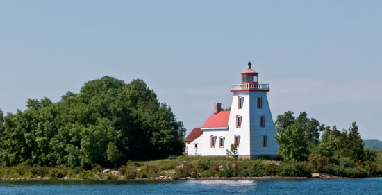
Strawberry Island Light
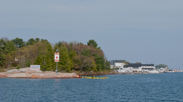
Killarney Channel
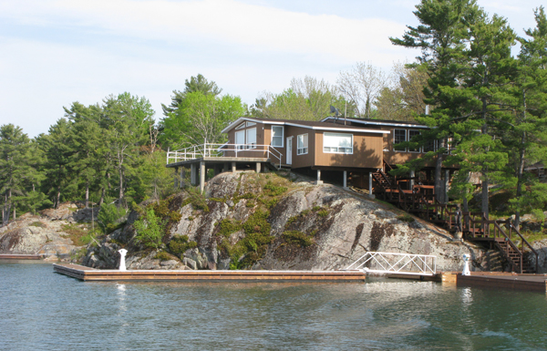
I Could Live Here - Keep the Boat Out Front!
The Sportsman's Not Open Yet
Not the Same As the School Bus Fish and Chips
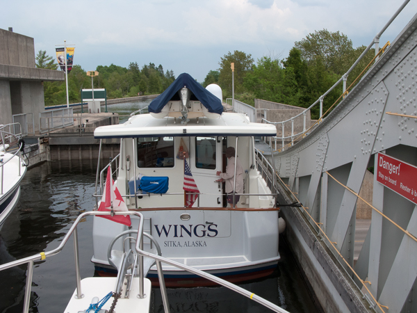
"Wings" Entering Thomas
View Out the Back Door
We were tucked away by 6:30, ready for more food, and an early night as we will have a long day tomorrow. Just before dark we heard the a loon calling, our first of the trip - we are up north now.....
Wednesday, May 25
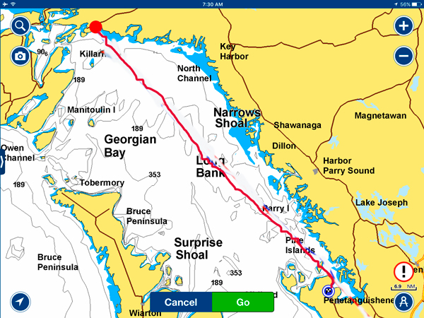
Today's Route - Thomas Bay to Penetang' 100 nm
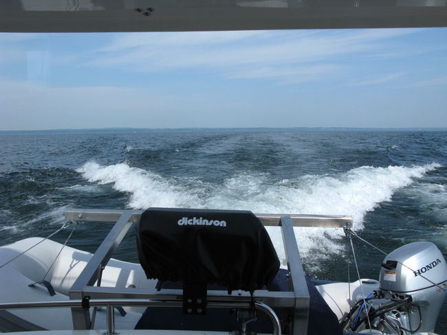
It was still twilight when we got up this morning and had the anchor pulled up at 6:00 am today to head down Georgian Bay with the goal of getting to Penetanguishene 100 nm or 14 hours away. A lot depends on the weather and we were lucky to have dead calm water at the start. The autopilot will be busy.
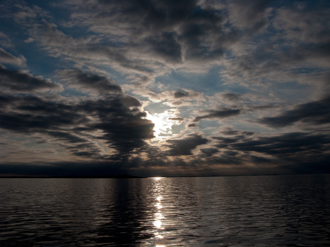
Sunrise About 20 Minutes After We Left
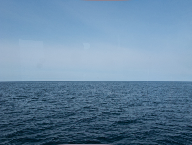
What We Saw Today
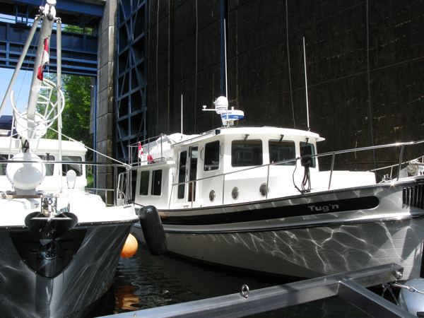
A little boring today as the waves were about 6", and we stared at a lot of open water for about 13 hours. Still , we covered alot of distance in that time and arrived in Penetanguishene (Penetang') which means "where the sand slides down the bank" to be greeted by Stephen and Fran at the dock. We are now the "Three Amigos"(our North Channel nickname on the CruiserNet) again. Slept well tonight.
Thursday, May 26
Today was spent catching up with Stephen and Fran's news, errands, washing and other chores. I tried to load a new software ypdate on my chart plotter (a mistake) and the system kept crashing with no apparent way out of it. Several calls to Furuno indicated that the only solution was a "Master Reset" where all information is wiped out and its like you took it out of a box with a huge amount of time and effort to reload everything. In desperation, I tried booting the system using the new software and after a couple of attempts was successful in getting it to load all the way through - boy, where we happy!!
Friday, May 27
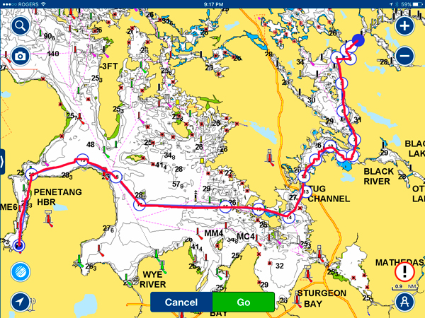
Pentanguishene to The Big Chute - 22 nm
Off on the adventure - the Three Amigos on the water together again!
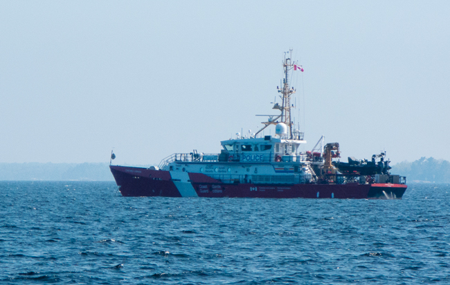
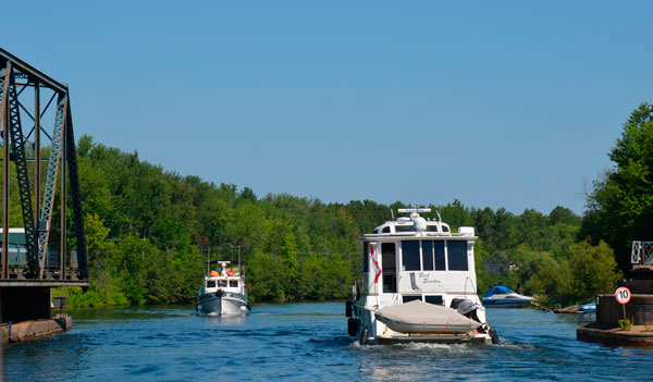
"Wings" and "Tug'n" still had some compass tweaking to do by running around in circles but we soon set a course for Port Severn lead by "Tug'n". Another beautiful day with light winds and brilliant sunshine. Along the way, we passed close by the Canadian Coastguard Vessel, "Constable Carriere," named after Constable J.L. François Carrière, a Royal Canadian Mounted Police diver who died in 1997. This 141' boat, one of the new Mid-Shore Patrol Vessels, will become one of the primary platforms for the joint Canadian Coast Guard and the Royal Canadian Mounted Police's Marine Security Enforcement Team in the Great Lakes and the St. Lawrence Seaway.
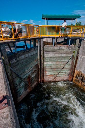
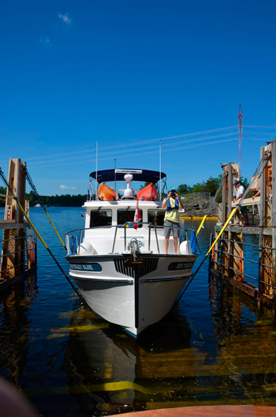
A short run later, we were at the first lock (No. 45) on the Trent -Severn Waterway, our home for the next two weeks.
Stephen on "Tug'n" and Bob on "Wings" Behind
A Bit About the Trent-Severn Canal
The Trent-Severn Canal was designed to take existing waterways that stretched from Lake Ontario to Georgian Bay and make them into a contiguous navigable waterway by damming rivers, cutting links between rivers and lakes, and adding a lock system for boats to rise and fall from the summit. The Canal was originally built by the British beginning in the mid 1800s to provide a secure route for boat traffic from the Canadian waters of Lake Ontario to Lake Huron since existing trade routes were vulnerable to attack by America. Its design and construction was a major civil engineering feat. By the time it was completed, the need for it had declined as railways and roads had been built and relations with America were no longer a cause for concern.
The system which covers 240 miles or lakes, rivers and canals from Trenton to Port Severn has 44 locks including the Mechanical Railway. It raises a boat almost 600 feet from Trenton to to its summit at Balsam Lake about 2/3 of the way along its length. From Balsam Lake to Port Severn, a boat falls about 260 feet.
The locks provide a way for a boat to gradually rise across the system to the summit and then fall to reach the water level at the end without negotiating fall and rapids. They really act as a set of "stairs" for boats.
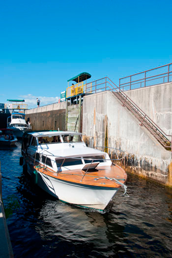
The majority of the locks are of the conventional type where a boat enters a lock chamber that has doors at each end. If the boat is to rise to water at a higher level, the doors are closed and water is let into the lock chamber from the higher level until the boat is at the level of the higher water. The doors are opened and the boat proceeds out of the lock. If the boat is downbound, i.e., going to a lower level, the doors are closed and water allowed to flow out of the lock chamber to the downstream side. When the boat is at the lower level, the doors are opened and it can move on its journey. In a conventional lock, the water is allowed to enter or escape from the lock chamber through various types of valves or openings in the lock gates. In a few cases, locks are put in series as the lift or fall is too great to be accomplished with one lock. The greatest lift height is 68 feet and the shortest height is only 3.5 feet.
Entering to Drop Down |
Start of Lowering Process |
Water Being Let out of Lock |
Leaving Lock |
Two of the locks at Peterborough and Kirkfield are hydraulic lift locks and will be explained when we reach them on our trip.
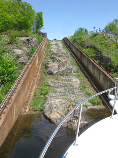
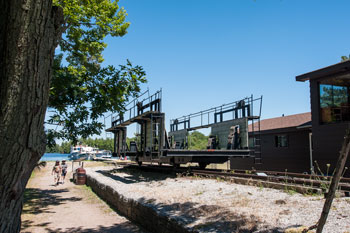
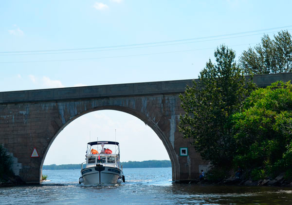
From here we decided to head onward for another interesting experience, the Big Chute Marine Railroad a few miles way. It is a unique machine akin to a lift for boats. The lift can accommodate as many as 9 small boats but often takes a mix of small and large vessels until full. As we were "upbound" to the highest level in the canal system, we drove the boat into a cradle-like structure that traveled about 600' up a fairly steep set of railway tracks pulled by a cable system. At the top, we crossed a road and then the tracks dipped back in to the water where we floated off to moor at the floating docks for the rest of the day. In a matter of seven minutes, we had risen 58' to the new water level.
Today, the Big Chute just carried Tug'n and Wings in one load and us in the next.
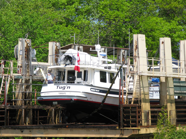
"Tug'n" Loaded Up and Ready to Go
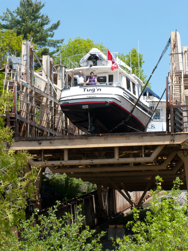
"Tug'n" Rising Above the Trees
STB Waiting to Begin the Ride Up
It's A Long Way Up!
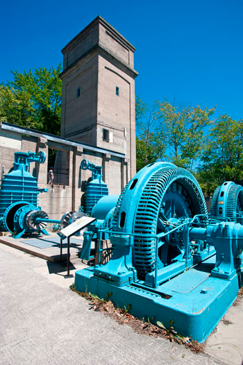
The Big Chute replaced an older version of the Chute that could not accommodate the volume and size of modern vessels and the old system and control house is preserved at an adjacent site. At the bottom, the old hydroelectric plant is also maintained as a historic site.
The Old Chute Carriage |
The Old Chute Incline |
Original Hydro Plant |
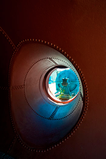
Original Riveted Penstock Pipe (~8' dia.) |

Saturday, May 28
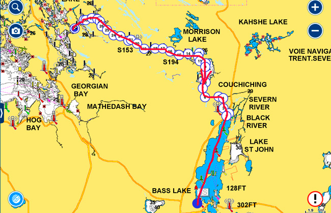
Big Chute Marine Railway to Orillia - 31 nm
We had a leisurely start to the day and stopped at the Waubic Inn for breakfast just a few miles from the Big Chute.
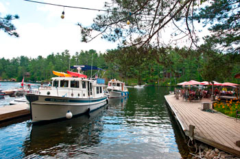
The Waubic's Docks
The Waubic Inn is only reachable by boat and is noted in the area for its great food. Unfortunately, Judy would not let me have "Full English Breakfast" that I was to need later in the day. Still, we all enjoyed our breakfasts before moving on to our second lock of the trip.
After Port Severn which is a comparatively small lock, Swift Rapids is like a canyon, with the top 47' above you. It is the second highest in the system.
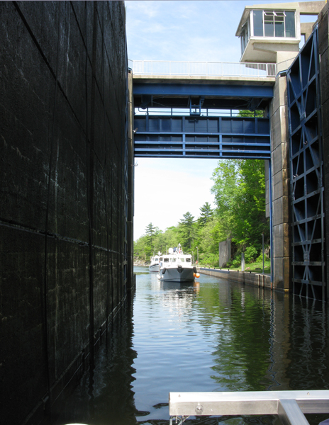
"Wings" Entering Swift Rapids Lock
Packed In and Ready to Go
A good run for the rest of the day to Orillia where we stayed at the Port of Orillia, an excellent marina.
We were meant to have some long dock lines delivered to us together with a package for Stephen. The vendor failed to deliver on his promise so we were stuck getting to his facility some 10 km. away. We managed to get a ride the next day from a Canadian Power Squadron member but when a neighboring boat heard of our predicament, the offered to drive me to get the lines. What a fine couple - Bob and Wenda!
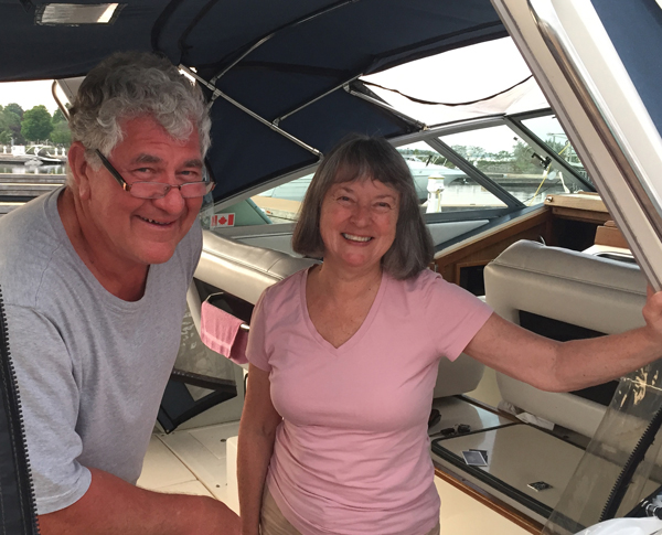
Bob and Wenda
Not only did Bob and Wenda help us out but they also took Stephen and I to Best Buy as his camera quit working. Wenda also drove us by Stephen's childhood home in Orillia so he could see it. What a great couple to go out of their way twice. They both grew up in Orillia and knew a number of people that Stephen's family knew.
Sunday, May 29
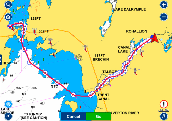
Orillia to Kirkfield Lift Lock - 27 nm
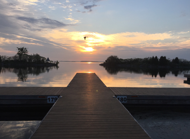
I awoke very early while it was still dark and made the coffee before taking a walk around. The sun was just coming up when I made it back to the dock for the sunrise.
A little later we headed, with Fran, for the Mariposa Marketplace just up the main street in Orillia to to splurge on lattes and other goodies. If you are ever in Orillia, be sure to visit this store/bakery/cafe. They have the most amazing selection of breads, cakes, sandwiches, pastries - just about anything to do with food and cooking it. We ended up with a Muskogie Berry Loaf, like a cake but with tons of berries in it.

Just the Cake Section!
The weather was very favorable this morning for the run across the northern part of Lake Simcoe to the Trent Canal before the winds picked up later in the day. Simcoe is relatively shallow and can kick up some good waves very quickly when the wind picks up so it was important to go with a good weather window. Last year coming back the waves increased from 1-2' to 3-4s in less than an hour. Many boaters underestimate the Lake to their regret, particularly the smaller, lighter boats!
We were rewarded with very calm water and a quick crossing, an ideal time to open STB's engine up to get it up to full speed for the first time this year. Just made 17 kts, down from previous years, but we are carrying a much bigger load this summer. The boat ran extremely well and, dropping down to a run of 10kts, was very comfortable.
STB Kicking Up A Big Wake (Dream on Alexis)
From the end of the Lake on, we spent much of our time in canals with little exposure to the hot breezes passing over the tops of the trees. To reach our destination for the day, we passed through five locks and it was mid-afternnon when we arrived at the top of the Kirkfield Lift Lock, a National Historic Site is one of nine similar locks in the world.
Talbot Lock
Many Bridges to Open
Along the way, Canal Lake in all the heat of the day, was not one of our favorite places with a very narrow buoyed channel and thick weeds that clogged the prop and rudder every couple of hundred yards. The Lake is known for its deadheads and we knew to go slow from our last trip three years ago. This time no ominous thuds were heard from submerged logs.
Going Through the "Hole" in the middle of Canal Lake
"Wings" Ahead of Us In the "Bathtub" at Kirkfield
The Kirkfield Lock is one of the 2 hydraulic locks in the Trent-Severn and in North America. I believe there are only 6 or 7 others in the world. The Lock has been modernized in recent times but the original Lock, built in the early 1900s, was one of the engineering masterpieces of its time in Canada.
It operates on a very simple principle. Two "bathtubs" filled with water sit on top of immense hydraulic cylinders which are inter-connected by a large pipe with a valve in the middle. With the valve open, the two tubs counterbalance each other. By adding a small amount of water to one tub, it slowly drops since it is heavier, pushing the other tub up.
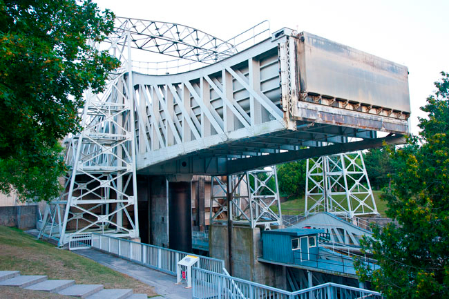
To raise a boat up, they adjust the volume of water in the tubs so one lowers, a gate is opened, and the boat enters. The gate is shut and sealed and a small amount of water is let into the tub on the high side to make it heavier than the other tub. The tub and the boat rise to the top, the gate is opened and, in less than 2 minutes, a boat has been raised 49 feet with no turbulence.
The top at Kirkfield was definitely the better choice this evening as we had a good westerly wind right behind us - an 85 deg. F wind but at least air movement and few bugs. The generator ran until bedtime, powering the A/C to cool us down. Three years ago, we had the same weather pattern - what a coincidence!
To complement this morning's sunrise, we had a colorful sunset.

May 16 - 22 |
May 23 - 29 |
May 30 - Jun 5 |
Jun 6 - 12 |
Jun 13 - 19 |
Jun 20 - 26 |
Jun 27 - Jul 3 |
Jul 4 - 10 |
Jul 11 -17 |
Jul 18 - 24 |
Jul 25 - 31 |
Aug 1 - 7 |
Aug 8 - 14 |
Aug 15 -21 |
Aug 22 - 28 |
Aug 29 - Sep 4 |
Sep 5 - 11 |
Sep 12 - 18 |
Sep 19 - 25 |